MIT xPRO · Designing & Building AI Products and Services · 2026
Capstone Project

Earth
Steward

A mobile-first AI platform empowering private landowners to navigate infestation threats, secure program funding, and find professional resources through a structured, AI-guided workflow.

11.96
Acres · Hartsel, CO
8,990
Feet · Montane Life Zone
26K
Acres · Active Infestation Nearby
Joel Heaton · UX & Product Designer
A joelheaton.com UX & AI Methodology
View Live Prototype
Stage 1 · Intelligence — The Problem

Colorado's forests are under siege.

The resources are sometimes hard to secure. The funding programs and the shutdowns are in turmoil. We have been tracking these metrics, problems and issues for decades, but now with AI we have the intelligence to connect the landowners in a way we never have been able to before — in the field and from a management perspective.

Meanwhile
Infestations spread
2026 snowpack hasn't come and record drought
Climate change is running ahead of every projection
Colorado's western forests are a tinderbox
Summer 2026 approaches
Forest infestation — dead and dying trees on hillside Forest infestation — wide view of beetle kill Forest infestation — close-up branch damage
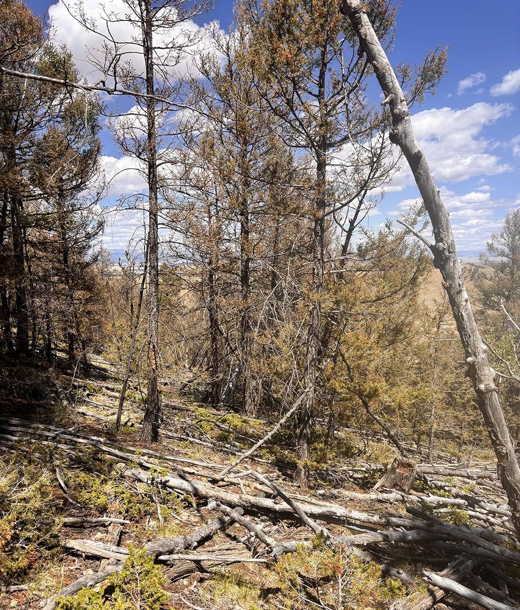
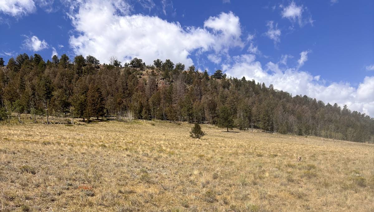
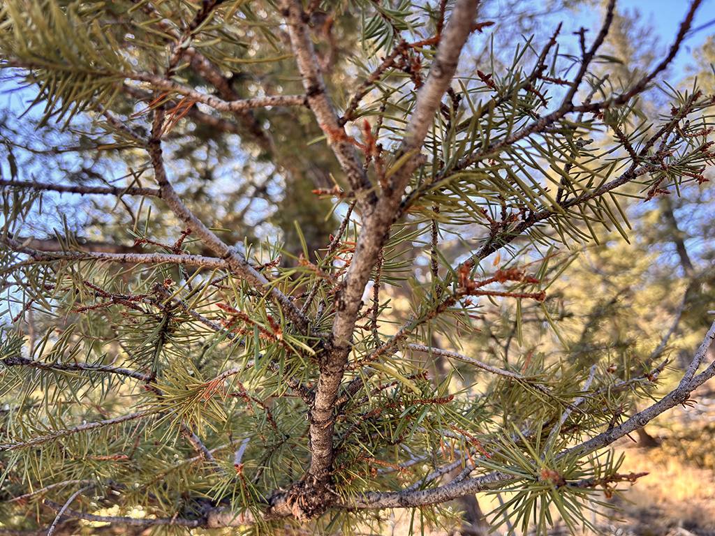
Hartsel, Park County, CO · Joel Heaton field documentation
How Earth Steward Maps to the MIT AI Design Process

All 4 stages. Applied in practice.

Earth Steward was designed using a hybrid UX & AI Design framework based on MIT xPRO - Designing and Building AI Products and Services — not as a theoretical exercise, but as a working prototype deployed at 8,990 feet in Hartsel, Colorado.

Stage 1 · Intelligence
Define AI behavior + metrics
SAM 3 segments tree canopies from aerial. Field photos identify species and stress. RAG chatbot guides the 7-stage workflow. Infestation proximity triggers alerts. KPI: landowner takes action.
Stage 2 · Business Process
Strategic role + operational targets
Replaces the need for an immediate forester visit. Automates funding program matching. Coalition tool enables group RCPP applications. Data licensed to CSFS, BLM, insurance providers.
Stage 3 · AI Technology ← We Are Here
Technology choices + IP strategy
React Native + Mapbox offline + Claude API + SAM 3. Provisional Patent filed. Trade secret protection for AI methods. NDA required before pitching to partners.
Stage 4 · Tinkering → Backlog
Deploy + monitor + iterate
Location and Impact screens live at joelheaton.com. Resources, Applications, Review screens in backlog. React Native project scoped for V2.
The 7-Stage Workflow
1 Location Map parcel, GPS, SAM 3 aerial
2 Impact Walk land, field photos, log
3 Resources Agencies, programs, funding
4 Application Apply for EQIP, CSP, HFRP
5 Review Licensed forester sign-off
6 Mitigation DIY or contractor selection
7 Future Review Long-term monitoring cycles
MVP Test Site
Parcel R0025252 · Hartsel, Park County, CO
Joel owns the land — real user, real stakes, physical access
Good cell signal — demonstrates every Earth Steward feature in one location
Stage 1 · Live Prototype — Location Screen

GPS lock. Parcel mapped. Threat detected.

The landowner opens Earth Steward standing on their property. Within seconds the parcel is mapped, the life zone identified, and a nearby infestation warning is already surfaced — before they've taken a single step.

What the screen does
GPS lock — identifies Parcel R0025252, 11.96 acres
Elevation engine — auto-detects Montane life zone at 8,990 ft
Life zone — surfaces likely species: Lodgepole, Ponderosa, Aspen, Douglas-fir
CSFS data layer — Western Spruce Budworm alert triggered automatically
SAM 3 aerial — canopy scan planned for next iteration (green outlines, yellow stressed trees)
Offline-first — all data cached locally, works without cell signal
⚠ Infestation Alert — Live on Screen

"Western Spruce Budworm detected nearby — tap to identify affected trees"

This alert is triggered by CSFS ArcGIS data showing 26,000 acres of active infestation in Park County. The landowner sees this the moment they open the app.

Live at
joelheaton.com/test/earthsteward/v2react/
9:41 ●●●● WiFi 🔋
Earth Steward
Stage 1 — Location
✓ Located
⚠ Western Spruce Budworm detected nearby — tap to identify affected trees ›
Parcel R0025252 · YOUR LAND
City
Hartsel
County
Park
Acres
11.96
Elevation
8,990 ft
🌲 Life Zone
Montane (8,000–10,500 ft)
Continue to Impact →
📷
Camera
🗺
Map
🛠
Tools
📚
Learn
💬
Chat
Stage 2 · Live Prototype — Impact Screen

Walk the land. Document everything.

The landowner walks their property. Every observation — a snag, a badger hole, a dense stand of fir — is logged with GPS, timestamp, and SAM 3 AI identification from a phone photo.

What the screen does
Field log — observations stack as the landowner walks, GPS tagged
SAM 3 field mode — photograph a tree, AI identifies species, stress signs, pest damage
Marker + pencil tools — annotate directly on the map
Offline-first — everything saved locally, syncs when signal returns
Infestation context — budworm and beetle alerts visible throughout
SAM 3 — What it identified on screen
Ponderosa Pine — 94% confidence, healthy canopy ✓
Snag — Dead Standing Tree — 87% confidence, possible beetle damage ⚠
Bunchgrass — 91% confidence, ground cover healthy ✓
Rock outcrop — 96% confidence, possible reptile habitat ✓
Unknown shrub — 52% confidence, flagged for forester review ?
Live at
joelheaton.com/test/earthsteward/v2react/
9:48 ●●●● WiFi 🔋
Impact
Stage 2 — Field Documentation
🌲 Montane · 8,990 ft · R0025252 Offline ready
⚠ Known infestations of W. Spruce Budworm, Mtn Pine Beetle active in Park County. Early documentation this summer is critical.
📷 Tap to photograph & identify
Field Log 4 observations
🦡
Badger hole NE corner · 9:32 AM · GPS tagged Wildlife
🌲
Snag — possible beetle entry Center field · 9:38 AM · SAM identified ⚠ Pest
🪨
Rock pile — reptile habitat SW ridge · 9:41 AM · GPS tagged Terrain
✏️
Dense fir stand, check for budworm · Pending sync
Continue to Resources →
📷
Camera
🗺
Map
🛠
Tools
📚
Learn
💬
Chat
The Design Pattern — Field-Proven Since 2018

This pattern wasn't invented for Earth Steward.

The Location → Impact → Details → Review flow was first built and validated with real field operators at DCP Midstream in 2018. Earth Steward applies the same proven structure to a new domain — 8 years later, at 8,990 feet.

Stage EVE App — DCP Midstream (Oil & Gas, 2018) Earth Steward (Forest Stewardship, 2026)
1 · Location GPS pin at spill site · Facility ID · Event type GPS parcel boundary · Elevation · Life zone · SAM 3 aerial scan
2 · Impact Air / Soil / Water — what was affected · Material details Walk land · Field photos · SAM 3 species ID · Field log · Annotations
3 · Details Measures taken · Timeline · Enablon integration Resources · Funding programs · Forester match · Application prep
4 · Review Review before submitting to regulatory system Licensed forester verification and sign-off
Mobile user Field Operator — reporting spills in the field Private Landowner — documenting forest health
Desktop user Plant Manager — OneSight scheduling dashboard Forester + Agency — management plans, reports, coalition
UT Validation 8 operators across 4 oil fields · 100% comprehension Joel as primary user · Hartsel land · MVP planned
Why this matters for the capstone

Earth Steward isn't a student project built from scratch. It's the application of a field-tested UX pattern — validated with real users under real conditions — to one of the most urgent conservation challenges of our time. The methodology made it repeatable.

Same 4-stage flow — proven in oil & gas, applied to forestry
Mobile first — field conditions drive design decisions in both
Desktop companion — management view for the professionals
AI adds the layer — EVE had no AI; Earth Steward has SAM 3, RAG, ML
Stage 2 · Business Process + Stage 3 · IP Strategy

Built to scale. Protected to last.

Earth Steward has a multi-stakeholder business model and an IP protection strategy in place — because the goal isn't just to build a good app, it's to own the standard for private land stewardship.

Business Model — Who Pays
Private Landowners Subscription
CSFS / Forest Service Data licensing
BLM Colorado Government contract
Insurance Companies Wildfire risk API
Conservation Groups Grant licenses
Universities Research partnerships
IP Protection — In Progress
Provisional Patent — filing now, ~$65 Micro Entity, 12 months "Patent Pending"
Trademark "Earth Steward" — USPTO search + filing
Trade secret — AI methods and training approaches protected by NDA
GitHub + brief timestamps — establish conception date legally
The Intelligence Stack
SAM 3 (Segment Anything) — aerial canopy detection + field species ID
Claude API (RAG) — contextual guidance through all 7 stages
Mapbox offline — parcel boundaries, GPS tracking, no-signal maps
CSFS ArcGIS — live infestation heatmap, proximity alerts
Elevation engine — auto life zone + species probability
React Native — iOS + Android, one codebase, offline-first
Target Partners (Post-PPA)
World Wildlife Fund Nature Conservancy CSFS US Forest Service BLM Colorado Wildfire insurers
Stage 4 · Tinkering — What's Next

A real MVP based on actual data and a stewardship plan.

The foundation is proven. The pattern is validated. The next phase completes the 7-stage workflow and moves Earth Steward from prototype to MVP.

Completed ✓
Stage 1 · Location — live at joelheaton.com
Stage 2 · Impact — SAM 3 field ID, field log, offline-first
Color system — dark mode Figma variables established
8-screen wireflow — all 7 stages mapped in Figma
GitHub repos — earth-steward-mobile, earth-steward-map
In Backlog →
SAM 3 aerial canopy scan — green outlines + yellow stressed trees on Location
CSFS heatmap layer — zoom out to county view, toggle beetle/budworm
Stage 3 · Resources — agencies, funding programs, forester database
Stage 4 · Applications — EQIP, CSP, RCPP, HFRP workflow
Desktop version — forester + agency project management view

Joel Heaton

UX & Product Designer · MIT xPRO AI Design · joelheaton.com

Earth Steward · Capstone 2026
Built with a joelheaton.com UX & AI Methodology